James Hall & Sarah J. Srygley
1824-1906
![]()
Parents Of Five Preaching Sons Including
F.D. Srygley &
F.B. Srygley Who Moved
To Coal Hill, Arkansas In 1887 From Rock Creek, Alabama.
![]()

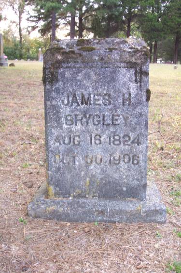
James
H.
Srygley
Aug. 16, 1824
Oct. 30, 1906
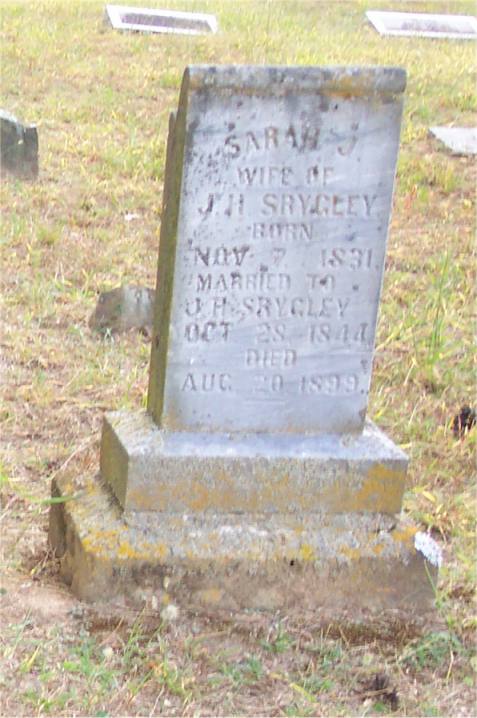
Sarah J.
Wife Of J. H. Srygley
Born Nov. 7, 1831
Married To J. H. Srygley
Oct. 28, 1844
Died Aug. 20, 1899
GPS Coordinates
N35º 26' 437" x W 93º 39' 581"
19' Accuracy
Facing East
![]()
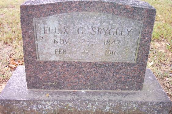
Felix G. "Bud" Srygley
1847-1916
"Uncle Bud"; Srygley died at his home in Clarksville, Ark., on February 22, 1916, and was buried at Coal Hill, Ark., his old home town. He was baptized by T. B. Larimore, about forty-five years ago, at Rock Creek, Ala. Later he and his brother, F. D. Srygley, led a colony of Alabamians to Coal Hill, Ark., where many of them yet live. "Uncle Bud"; was a little over sixty-eight years old. He leaves a wife and several children to mourn his loss. He had been a very successful man in business, which he continued till his death. He had been failing in health for several years and died of paralysis. Brother Srygley was brother of Brother F. B. Srygley, of Nashville, Tenn. We should not weep as the hopeless. The writer spoke to the many friends on the occasion of his burial.
— M. L. Lawrence, Gospel Advocate, (1916): 426.
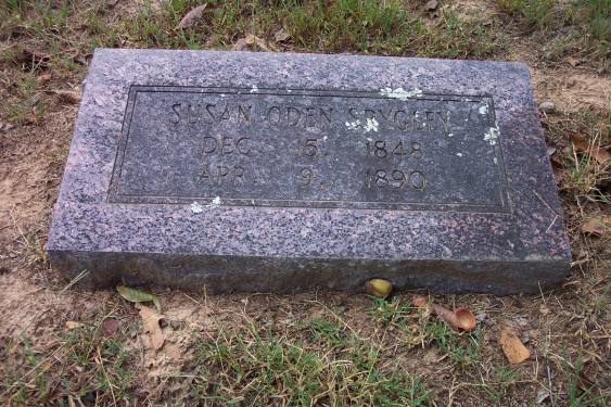
Eldest Son Of J. H. & S. J. Srygley
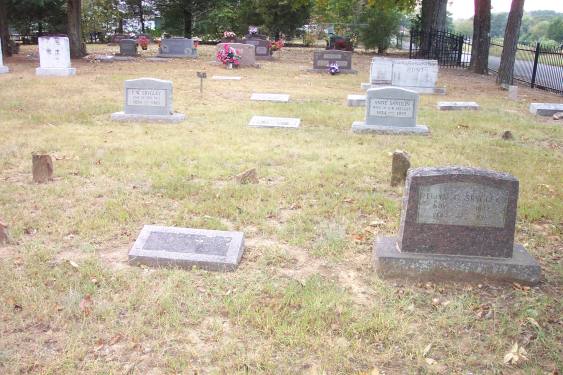
Susan
Oden Srygley
Dec. 15, 1848
Apr. 9, 1890
Felix
G.
Nov. 23, 1847
Feb. 22, 1916
GPS Coordinates
N35º 26' 448" x W 93º 39' 590"
19' Accuracy
Facing East
![]()
Fernando W. Srygley
1854-1920
Second Son Of J. H. And S. J. Srygley
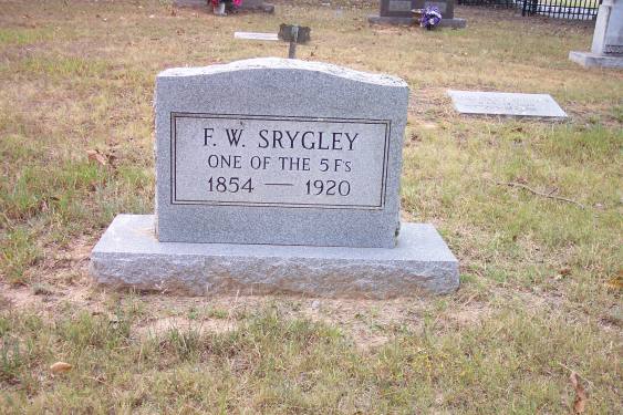
F.W. Srygley
One Of The 5 F's
1854-1920
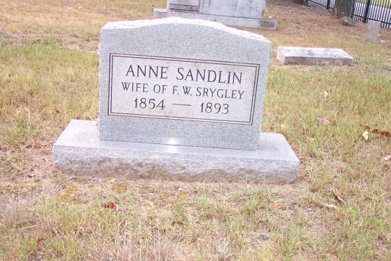
Anne Sandlin
Wife Of F.W. Srygley
1854-1893
GPS Coordinates
N35º 26' 450" x W 93º 39' 592"
19' Accuracy
Facing East
![]()
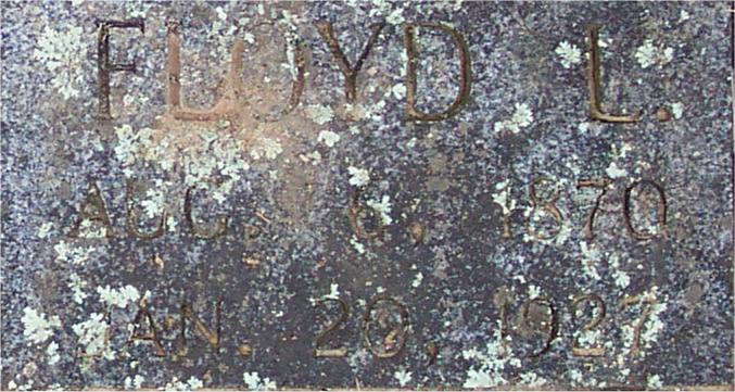
Floyd L. Srygley
1870-1927
Youngest Son Of J. H. & S. J. Srygley
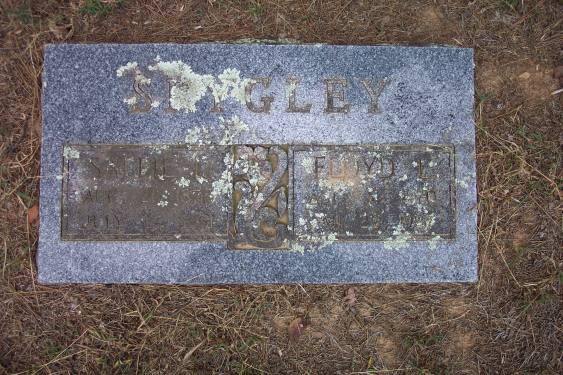
Sallie L.
Aug. 21, 1876
July 3, 1951
Floyd
L.
Aug. 6, 1870
Jan. 20, 1927
GPS Coordinates
N35º 26' 439" x W 93º 39' 591"
19' Accuracy
Facing East
![]()
Directions To Srygley Family Cemetery
Location: Coal Hill,
Johnson County, Arkansas
Latitude: 35º26º452ºN Longitude: 093º39º579ºW
Directions: On Arkansas' I-40 take Exit 47 and turn south on Hwy164.
Travel 4.1 miles, then turn right (west) on Rabbit Hill Rd. The road
will appear to fork, but stay straight on Rabbit Hill Rd. .2 miles
and the Srygley Cemetery will be on your left.
![]()